Gravelocalypse
May 16, 2026
8am - Yellville City Park
Yellville Arkansas
Welcome to Gravelocalypse!
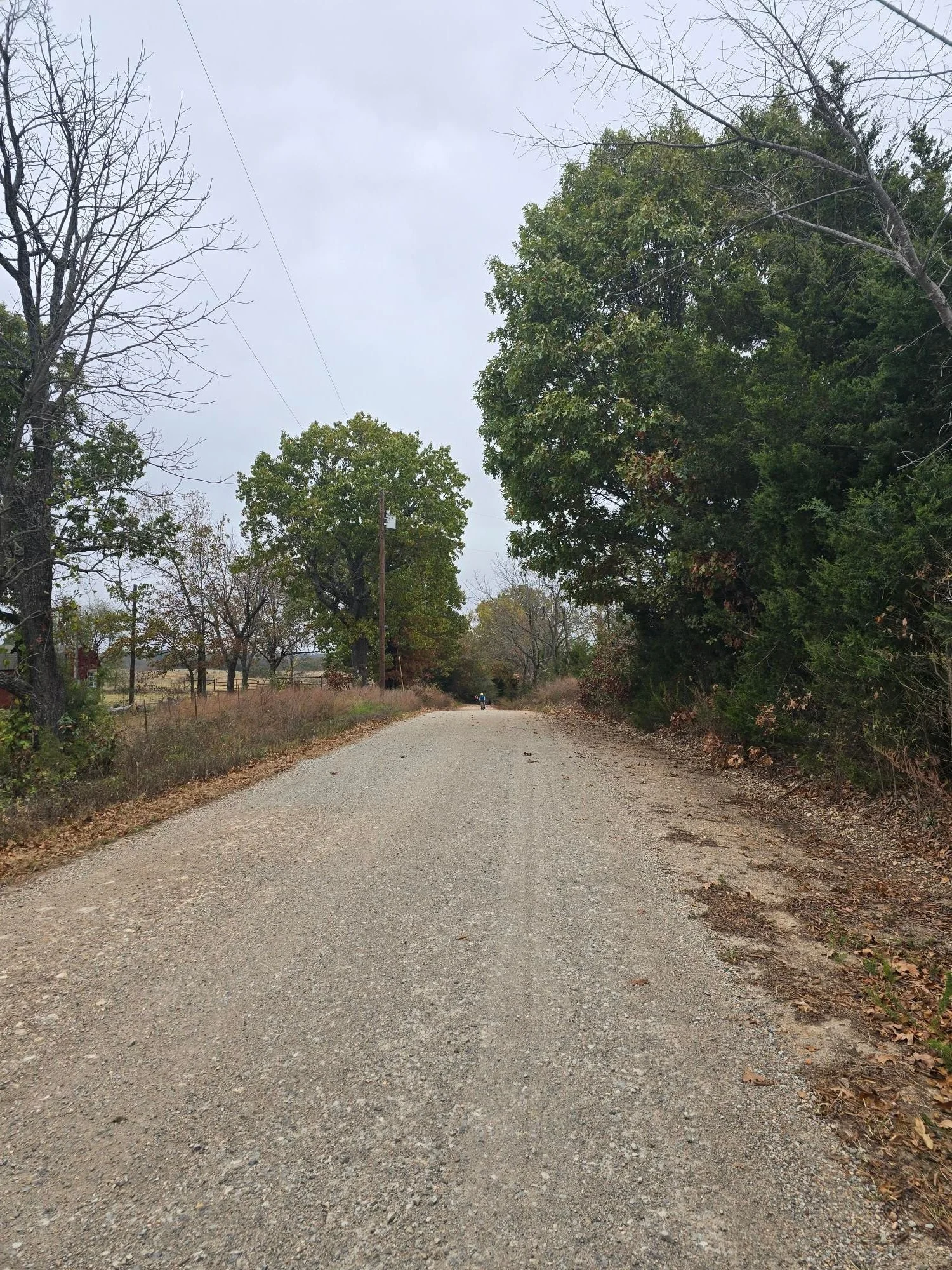
If you haven't heard about Marion County Gravel, you're in for a treat. Riders will experience beautiful views of the Buffalo River Valley and the Ozark mountains. There are natural springs, creeks ....and hills. Did we mention the hills??
Gravelocalypse is hosted by TTONCA
The Trail Team of North Central Arkansas
TTONCA is a 501c3 charity.
100% of the proceeds of this event goes to trail work in North Central Arkansas.
The race director is Shannon Baker, a lifelong area resident and cycling advocate.
Click here if you’d like more information on TTONCA. Be sure to check out their most recent accomplishment - A mountain bike trail expansion of Oak Ridge Mountain Bike Trails at Bull Shoals White River State Park.
Syllamo Events is a TTONCA member and we are honored to advertise this event.

Results
Click the results you want to view. This should download a PDF. Check browser settings if it does not download.
Records
55 Mile: (XXXX GPS Average)
Male:
Female:
74 Mile: (XXXX GPS Average)
Male:
Female:
37 Mile: (XXXX GPS Average)
Male:
Female:
21 Mile: (XXXX GPS Average)
Male:
Female:

Race Details
-
Gravelocalypse was created by Shannon Baker. A lifelong resident of North Central Arkansas who loves all things cycling and outdoors.
Riders may choose from one of four of his favorite routes.
Expect a diverse landscape that includes stunning views, creek valleys, dense forestry, and open farmland. It is hard to find an area that packs more scenery into a single ride.
-
The start and finish is located at Yellville City Park in Yellville Arkansas.
"Yellville City Park" located at “Potter, Yellville, AR 72687” along Hwy 14.
Amenities include restrooms with running water, a playground, walking trail, basketball courts, tennis courts, baseball diamonds and more. It is an excellent venue for family fun.
Note: This is a city park that prohibits alcohol and firearms.
-
To be determined
-
Included with registration:
Tent camping at Yellville City Park
Car camping in the parking lot at Yellville City Park
Not allowed at Yellville City Park:
RVs / Trailer Campers
Other Options:
Numerous private campgrounds and some public campgrounds.
A notable option is the National Park Service campground “Buffalo Point” located 25 Minutes south of Yellville.
Nearby Cities:
Mountain Home Arkansas and Harrison Arkansas are the closest cities/towns. Both are approximately 30 minute drives to race start/finish. Either option would provide more lodging, food, and recreation opportunities if needed.
-
8am for all distances
-
The first mile of the race will be led by a vehicle to ensure safety along the highway and to neutralize the start.
-
None.
Some of these hills are steep and the routes can be rugged. Some riders might average less than 8 miles per hour. Please consider this in the selection of your distance option.
-
You do you.
We’ve seen all types of bikes ride the roads in our area.
That said, we find these routes the most enjoyable when we prioritize the following:
Tires:
Punctures are common. Not necessarily higher than other races but local riders tend to lean toward durable rubber compounds with puncture protection. We also lean toward larger volume knobby tires.
Gearing:
Our hills are steep, punchy, and relentless. Most local riders prioritize wide range, low gearing. Don’t expect to get up to speed and sustain a high gear for a long time before there’s another hill to climb.
-
All routes are relatively similar.
The majority of the miles are gravel. Pavement is as minimal as possible.
Gravel:
Expect smooth and rough gravel to ebb and flow throughout. No part of the course is required hike-a-bike or mountain bike territory. That said, some sections could be relatively rough compared to what you are accustomed to riding.
Water Crossings:
Maybe. There are several low spots that can retain water but we've never seen anything to cause alarm. Pre-race emails will address any causes of concern.
Mud / Sand:
Mud could be a challenge if there has been recent heavy rain.
Some routes have brief sand pits that can catch you off guard. These tend to be at the bottom of valleys near creeks.
-
The course will be marked but we highly recommend using GPX. There are dozens and dozens of turns that could take you off course.
Note: Expect to climb 100ft per mile on every route. Some hills are small and punchy - GPS does not record accurate elevation. If you map this on your own, the mapping tool might be slightly different than the route provided. Please double check if you opt to create your own file.
(Links to routes will be provided here as soon as possible. Look for emails if you’re registered and social media posts if you’re following on Facebook.)
-
Expect short and punchy hills that average 100ft of gain per mile.
Many hills are too small to record gain accurately. It is normal to record a range from 75 to 125 feet per mile.
Low points are approximately 550 feet above sea level.
High points are approximately 1,300 feet above sea level.
-
We will have course markings. Specifics will be detailed in a pre-race email.
Nothing will prevent you from going off course.
We STRONGLY suggest you download the route map.
-
Use “Yellville Arkansas” on your weather app for the most accurate predictions.
The month of May tends to be cool in the morning, warming up fast, sometimes becoming hot.
Our region is extremely humid. 99% humidity is a daily norm in Spring and Summer.
-
21 Mile - 1 Aid Station: Mile 9
37 Mile - 2 Aid Stations: Miles 14, and 25
55 Mile - 3 Aid Stations: Miles 14, 30, and 43
74 Mile - 4 Aid Stations: Miles 14, 30, 50, and 61
-
Hydration: Electrolyte mix and water.
Solid Foods: No specific items will be promised but fruit, pickles, chips, candy (hard and/or chocolate) can be expectedOur aid stations will be well stocked and riders can expect the similar items at each location. Specific brands could vary.
We do not supply NSAIDS or other pain relievers.
Every aid stations will have basic first aid. -
No.
-
Currently being planned. We hope to offer a lively post race experience that you want to stick around for.
-
Custom awards for each finisher.
-
Shannon Baker
(email)
-
Tentative:
Friday evening ride to Gray Springs.
Race start to Gray Springs is approximately 5.5 miles. Covers the first 5 miles of the course. Features approximately 500 feet of climb one way. Mostly descending on the return.
Roughly 11 miles total.